
Why go
Awamata is distinctive because the water slides across a long rock surface instead of making one dramatic free fall. The surrounding valley path gives the stop more depth than a roadside waterfall viewpoint and makes it worthwhile for a slower nature walk.
Field Notes
Awamata Falls is a broad river scene in the upper Yoro Valley rather than a single narrow column dropping vertically from a cliff. Chiba's tourism guide describes about thirty metres of height spread across a flowing length of roughly one hundred metres. This long descent is the feature to look for when choosing a viewpoint: the eye follows water down the rock surface instead of concentrating on one plunge. Leave time to take in the whole setting, including the wooded banks, before moving closer to individual sections of the cascade.
Otaki Town likens the gently sloping rock to a slide, a useful way to picture the waterfall's form before arriving. Autumn foliage changes the frame around that pale moving water, with the town identifying late November to early December as the usual viewing period. The interest is in the combination of colour, rock and river, so a good visit does not depend on finding one exact photographic composition. Look both along the cascade and toward the surrounding slopes. Outside the autumn season, the shape of the flowing water remains the same organising feature of the landscape.
The walking plan needs to follow the current restrictions. Storm damage has affected the valley's trails, and the town's August 2026 notice permits only a short return section from the Awamata end of the waterfall trail, with a turnaround about one hundred metres along. Entry from the downstream Kozawamata side remains prohibited in that notice. Rising water after rain can bring wider closures. Treat the waterfall visit as a visit to the permitted surroundings, rather than assuming that an older description of a longer riverside circuit is usable. Check the latest town notice before travelling and obey the barriers at the site.
Access also involves a final local journey, so separate reaching the Yoro Valley area from arriving at the waterfall. The national tourism listing identifies an approach from Kazusa-Nakano Station and notes a charged town car park with a further walk. Anyone using public transport should confirm the current connection and return option before departure; a station name alone is not a complete route. For drivers, allow time for parking and the pedestrian approach. With the trail situation in mind, a focused visit to the falls and its permitted viewpoints is a clearer plan than committing to a through-walk between different valley access points.
Planning Notes
Suggested time on site: 45–120 minutes. Keep travel and waiting time separate from that estimate.
Access reference: From Kazusa-Nakano or Yoro-Keikoku Station, continue by local bus toward Awamata Falls. Check the final walking or connecting leg when choosing your route.
Location
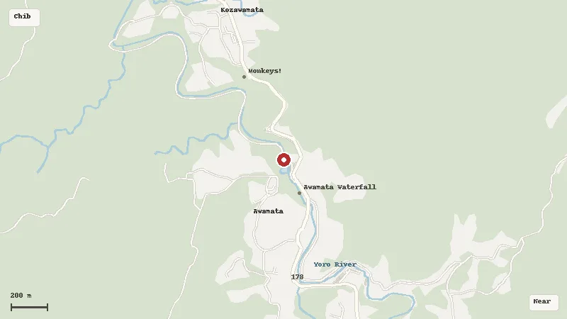
Map data © OpenStreetMap contributors