
Why go
Kora Taisha combines regional religious importance with a mountain setting. Its status as old Chikugo's foremost shrine and surviving Edo-period architecture give the precinct historical weight, while the approach near Mount Kora's summit adds a distinct sense of elevation and distance from the city below.
Field Notes
Kora Taisha places a major regional shrine in a mountain setting above Kurume. As Chikugo's ichinomiya, it held the position of foremost shrine in the old province, with devotion also extending into neighboring Hizen. Its principal deity is Kora Tamatare no Mikoto. The prefectural tourism guide distinguishes a traditional foundation in the year 400 from the much later buildings that visitors encounter today. Keeping those two timescales apart makes the site easier to appreciate: the shrine's inherited religious importance and its surviving architecture tell related but different stories.
The main sanctuary, offering hall and worship hall were erected under the third Kurume lord, Arima Yoritoshi, in 1660. The prefecture identifies the group as early-Edo gongen-style architecture and a national Important Cultural Property. After the ascent, spend time considering the buildings as a connected arrangement rather than isolating a single facade. The shrine also preserves a Heike Monogatari manuscript among its important treasures. Those holdings add literary and devotional dimensions to a visit, although a listed treasure should not be assumed to be on view during ordinary worship.
A longer visit can continue beyond the main precinct toward the inner sanctuary. The prefectural guide places it roughly fifteen to twenty minutes along a cedar-wooded path behind the principal sanctuary. It describes the place as the deity's former mausoleum site and associates its spring with sacred water. Treat that as religious tradition, and allow the inner sanctuary its own walking time rather than folding it into a brief stop at the main halls. The move from the formal buildings into the woods gives a different sense of the mountain's sacred geography.
For walkers, the shrine can also form part of the Kurume Korasan Olle route. The official itinerary is an 8.6-kilometer course graded intermediate to advanced, linking the Kurume University station area with Mii Station through places including the inner sanctuary, an azalea park and Myoken Shrine. The shrine itself is one point on that route, not the name of a short circuit around the buildings. Choose a dedicated shrine visit or the longer mountain walk according to ability, weather and available daylight. The broader itinerary connects religious sites, planted landscapes and views across the Chikugo Plain.
Planning Notes
Suggested time on site: 45–90 minutes. Keep travel and waiting time separate from that estimate.
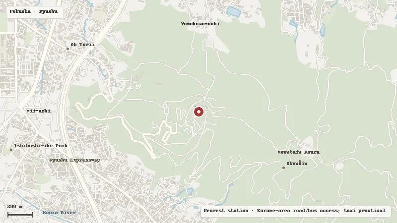
Access reference: Kurume-area road/bus access; taxi practical. Check the final walking or connecting leg when choosing your route.
Location
Map data © OpenStreetMap contributors