
Why go
The appeal is the scale and repetition of the tree line rather than a single viewpoint. Because the same corridor reads differently with fresh green, autumn color or bare winter branches, the avenue is a landscape experience shaped by season and perspective.
Field Notes
Makino’s Metasequoia Avenue looks monumental enough to seem historic, but the tree line is a modern landscape created through local agricultural and roadside projects. Roughly five hundred dawn redwoods extend for about 2.4 kilometres along a straight prefectural road toward the Makino highlands, with the Nosaka Mountains beyond. The strong perspective formed by the paired rows is the reason the road became widely photographed.
The first trees were planted in 1981 by the Makino Town Fruit Tree Growers Union as part of a farming and educational initiative known as the Makino Soil Learning Village. Additional planting followed as the road was extended and residents cared for the growing avenue. Makino Pic-land, the agricultural park beside the road, still reflects that connection with fruit growing and local farming. What visitors now see as a destination therefore developed from practical landscape work rather than from a ceremonial approach or ancient forest.
Metasequoia is a deciduous conifer, so the character of the avenue changes dramatically through the year. New foliage appears in spring, the canopy deepens through summer, leaves shift toward copper and reddish brown in late autumn, and winter reveals the symmetrical branches. Snow can add another layer, but any particular winter scene depends on weather rather than on a guaranteed seasonal display.
The road remains an active public road, which is the most important practical fact for visitors. The trees are not a pedestrian-only attraction, and stopping in the carriageway for photographs is unsafe. The best plan is to use lawful parking and designated visitor facilities, then observe the avenue without obstructing traffic or entering private agricultural land. The nearby Pic-land area gives the famous tree corridor a useful local context: this is part of a working rural landscape, not a detached photo installation. The value of the stop lies in seeing how a community planting from the 1980s matured into one of Shiga’s most recognizable seasonal roadscapes while continuing to function as ordinary transport infrastructure.
Pic-land provides lawful parking and visitor services beside the famous corridor, giving photographers a practical alternative to unsafe roadside stopping. Seasonal color should also be treated as variable: spring green, autumn copper and winter snow depend on weather and timing rather than on fixed calendar guarantees.
Planning Notes
Suggested time on site: 60–120 minutes. Keep travel and waiting time separate from that estimate.
Access reference: JR Makino Station; Makino Town Bus to Makino Pick-land. Check the final walking or connecting leg when choosing your route.
The local tourism association gives late November–early December as the usual foliage window. This is a seasonal reference, not a live 2026 color report; weather can shift the timing. The avenue remains an active public road rather than a gated garden. Follow the road-safety restrictions and use designated parking; no attraction opening hours are inferred.
Location
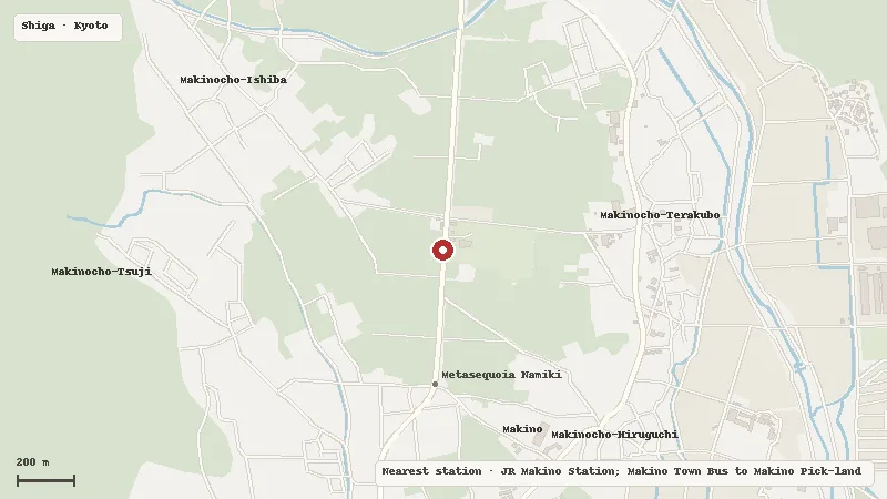
Map data © OpenStreetMap contributors