
Why go
The viewpoint is useful for understanding the scale of the Seto Inland Sea crossing rather than simply photographing the bridge. From the ridge, the bridge, islands and shipping water read together as one engineered and geographic landscape.
Field Notes
Washuzan’s second observation deck is one viewpoint within a larger hill landscape overlooking the Seto Inland Sea, the Seto Ohashi bridge system and the islands around Shimotsui. It should not be treated as interchangeable with the first observation deck, summit or visitor center. Each point has a different elevation and sightline, while walking paths connect them through the national-park landscape.
Washuzan belongs to Setonaikai National Park, designated in 1934 as one of Japan’s earliest national parks. The wider protected scenery combines islands, coastlines, settlements and cultivated slopes rather than separating “nature” from human land use. From the second deck, the Seto Ohashi bridges add another historical layer: large-scale modern transport infrastructure crosses a seascape long shaped by shipping, fishing and coastal communities.
The rest house beside the viewpoint reopened in a renewed form in April 2025. Its floors have different functions, including a shop and gallery, dining using local ingredients, a bookshop and free rest areas. These components do not all share identical opening days or hours. The building therefore should be planned separately from the outdoor observation space, especially for visitors arriving near closing or relying on food service.
Sunset is a major reason to choose this viewpoint, but late visits require practical attention. The main car park has its own closing time, and the normal approach to the building includes stairs, with separate provision for visitors who need accessible parking. Road conditions can also change. Municipal notices in 2026 documented a Route 21 closure and directed drivers and bus users toward updated access information.
For UMJ planning, the second deck works as a short panorama stop or as the starting point for a longer Washuzan walk. The useful approach is to distinguish landscape, rest-house services and transport conditions rather than combining them into one universal schedule. The viewpoint’s strength lies in how it layers national-park scenery, coastal settlement and modern bridge engineering into one readable panorama over the Inland Sea.
Folklore & legends
The name Washuzan is traditionally explained through the shape of the hill, said to resemble an eagle spreading its wings. This is a place-name tradition rather than a claim about the geological origin of the landform. It adds a cultural image to a viewpoint whose main significance is otherwise geographic: the hill rises above a field of islands and channels where the shape of the coastline is especially easy to read.
Planning Notes
Suggested time on site: 60–120 minutes. Keep travel and waiting time separate from that estimate.
Access reference: JR Kojima Station; local bus/taxi to Washuzan. Check the final walking or connecting leg when choosing your route.
The linked operator page concerns the optional Washuzan sunset-viewing bus. Boarding at JR Kojima Station does not require a reservation, but seats are subject to capacity; hotel passengers should ask their front desk. This does not impose a booking requirement or fixed hours on the second observation deck. The operator page provides e-ticket links. Do not use the wider mountain walking-route time as the duration of the deck alone.
Location
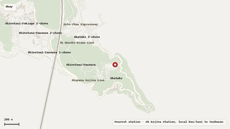
Map data © OpenStreetMap contributors